Toolbox
Polygon Clipping
Common spatial questions you'll want to answer are:
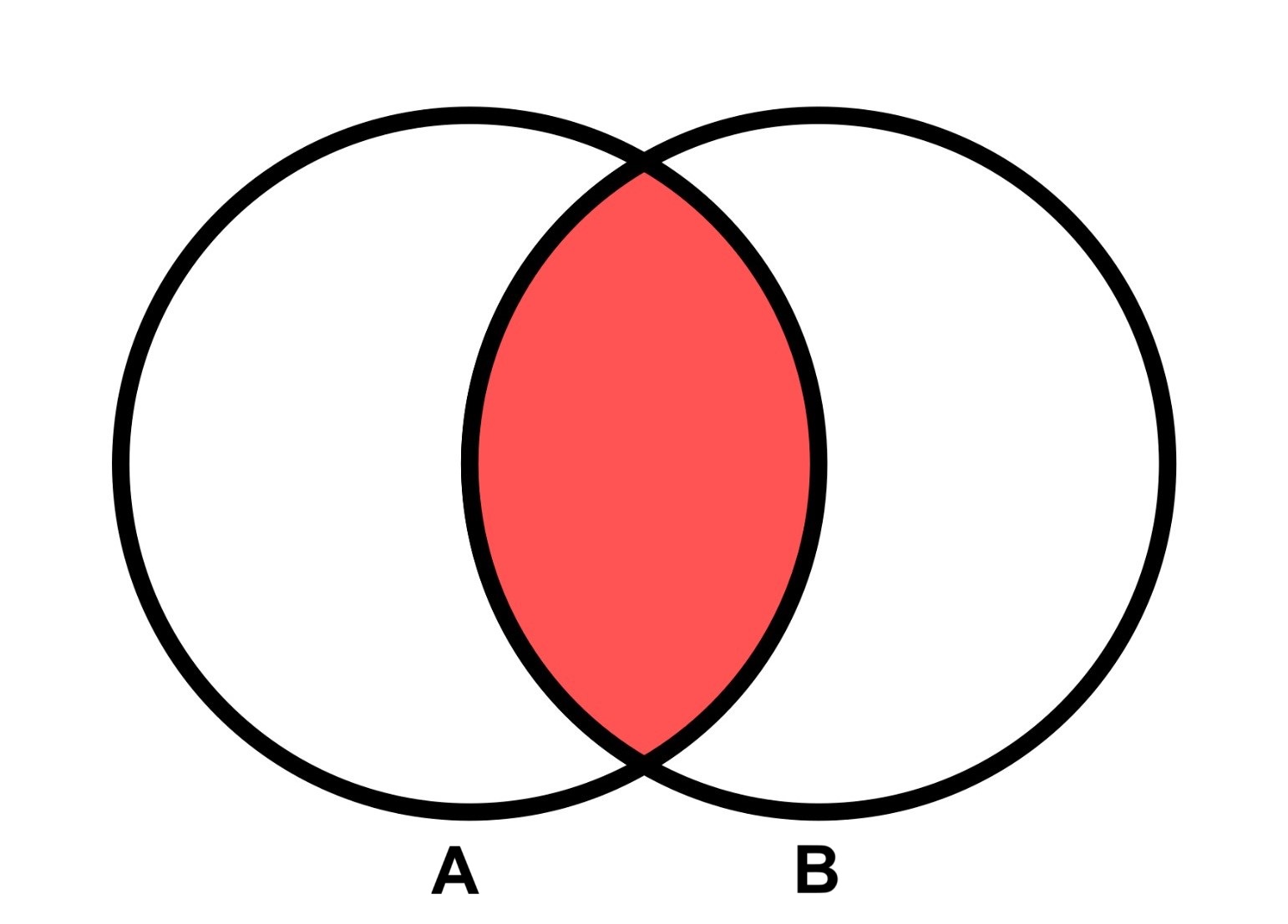
- what is the portion of a Polygon A overlaps with another Polygon B?
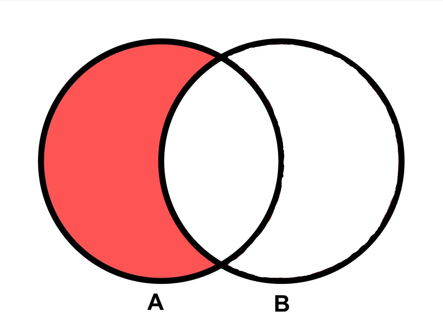
- what is the portion remaining in Polygon A if I remove the part overlapping with Polygon B?
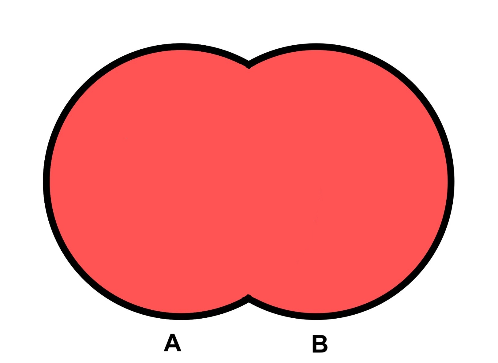
- what is the result of merging a set of overlapping Polygons such that their overlap is removed?
You can answer these questions with a combination of geometric clip operations.
| Intersection | Difference | Union |
|---|---|---|
 |  |  |
| overlap of A and B | A minus B | A or B |
The geoprocessing library offers multiple functions that are variations of these operations:
Clip
clip - clip a FeatureCollection using one of 4 different clip operations.
intersection- returns polygon(s) representing the shared area that all of the features in the collection have in common.- the clip function sees each of the features in the input collection as independent, which means if you have 10 polygons it will return the area all 10 polygons have in common. If what you want is to clip a feature A against a collection of other features B as a single unit, check out clipMultiMerge, it does the work of merging the features B into one big multipolygon for you. Otherwise you can loop through and intersect A with each feature in B one at a time, or you can call union on your group of features B first, then intersect with feature A.
difference- takes the first item in the feature collection and erases any part of it that overlaps with the remaining items in the feature collection. Think of it as a series of substractions and order your input collection appropriately.- Similar to ArcGIS Erase or QGIS Difference
union- returns a polygon/multipolygon that is the combination of all features with their overlap merged/dissolved.- Similar to ArcGIS Dissolve or QGIS Dissolve
- A common use case for this is is to remove overlap in your data so that you don't double count their area, before doing further operations like intersecting with another set of features.
- For example if you need to calculate the area of your entire sketch collection, and the sketches overlap, then simply calculating the area of each individual sketch polygon and summing them will double count any overlap and produce an invalid result. The solution is to union the sketch collection first then takes its area.
- Another example is if you have a coral reef dataset with overlapping polygons, and you just want to calculate the total geographic area of all reef, then the union is what you want to do first before calculating area.
Examples:
See polygon-clipping library used under the hood.
import { clip } from "@seasketch/geoprocessing";

// Erase portion of sketch overlapping with land features
clipped = clip(fc([sketch, ...landFeatures]), "difference");
clipMultiMerge
- clipMultiMerge - clips featureA with a set of featuresB by first merge featuresB into a single MultiPolygon. This is useful when you need featuresB to be seen as one feature, such as an
intersection, so that it can be done in one operation.- Used by intersectInChunks and intersectInChunksArea
// Erase portion of sketch not overlapping with land features
const clippedSketch = clipMultiMerge(sketch, landFeatures, "intersection");
Sequenced Clip Operations
To quickly perform a sequence of clip operations against different sets of data the following functions are available:
- clipToPolygonFeatures - takes a Polygon feature and returns the portion remaining after performing one or more clipOperations (intersection or difference) against multiple sets of features. Multiple additional configuration options.
clipToPolygonDatasources- takes a Polygon feature and returns the portion remaining after performing one or more clipOperations (intersection or difference) against one or more Datasources.
These are meant to simplify creating preprocessors. They use ensureValidPolygon to optionally enforce a minimum and maximum size for the results, as well as how to handle if the result have more than one polygon.
See src/functions/clipToOcean.ts, src/functions/clipToLand.ts, and src/functions/clipToOceanEez.ts in your project for examples of usage.
Higher Level Intersection
intersectInChunks- calculates area overlap between a feature A and a feature array B. Intersection is done in chunks on featuresB to avoid errors due to too many features.
The following two functions intersect two sets of features and calculate a metric with the remainder.
-
intersectInChunksArea- calculates area overlap between a feature A and a feature array B. Intersection is done in chunks on featuresB to avoid errors due to too many features.- used by overlapFeatures()
-
intersectSum- Returns an object containing the sum value of features in B that intersect with featureA, and the indices of the features in B that intersect with featureA. No support for partial overlap, counts the whole feature if it intersects. Used by overlapPolygonSum()
Vector Zonal Stats
Calculate sketch overlap with a set of features. Used in combination with precalc and toPercentMetric.
-
overlapFeatures (deprecated, replaced with overlapPolygonArea and overlapPolygonSum)
Older and lesser used functions:
- overlapArea - pseudo calculation of sketch percent overlap using a passed area value (number) representing the outer boundary for sketch (e.g. planning boundary)
Raster Zonal Stats
Geoblaze can be used directly for calculating zonal raster statistics including filtering to overlap with a Sketch feature. The geoprocessing framework offers some convenience functions that extend them with additional functionality:
High-level
- rasterMetrics calculate summary metrics (statistics/area) on a loa. If
sketchis passed will limit to raster values overlapping with the sketch (zonal statistics). Similar torasterStatsbut results are returned in a standardizedMetricarray format.- If
featureis a collection, then calculate metrics for each individual feature as well as the collection as a whole. This can be disabled by passingincludeChildMetrics: false. If your raster is a categorical raster you should passcategorical: trueand optionally pass the list ofcategoryMetricsValuesto pull out of the raster. - Examples
- Categorical example
- If
Older and lesser used functions:
overlapRasterClass- calculates sum of overlap between sketches and a categorical raster with numeric values representing feature classesoverlapRasterSum- returns sum of cells overlapping sketch with raster as a metric objectoverlapRasterArea- returns area of sketch overlap with raster as a metric object
Low-level
- rasterStats - is a lower-level all-in-one function for calculating up to 10 different raster stats in a single pass.
- includes calculation of are not currently supported by geoblaze. Supported through use of equal area raster projection.
- Optionally constrains to raster cells overlapping with feature.
Older and lesser used functions:
- getSum - returns sum of raster cell values overlap with feature. (not multi-band aware, first band only)
- getArea - returns area of valid raster cell values (not nodata) overlapping with feature. (not multi-band aware, first band only)
Group Overlap Analysis
Calculate group-level metrics by assigning sketches to groups (e.g. group by protection level)
High-level:
- overlapFeaturesGroupMetrics - generate overlap metrics for groups of sketches using overlapFeatures operation.
- overlapRasterGroupMetrics - generate overlap metrics for groups of sketches using rasterMetrics operation
- overlapAreaGroupMetrics - generate overlap metrics for groups of sketches using overlapArea operation.
Low-level building block:
- overlapGroupMetrics given overlap metrics (vector or raster) stratified by class and sketch, returns new metrics also stratified by group. Assumes a sketch is member of only one group, determined by caller-provided metricToGroup.
Helpers
Additional helpers used to build these toolbox functions:
- removeOverlap - removes overlap between feature polygons and returns as a single polygon or multipolygon.
- createMetric - create a metric object, with null values for unused properties
- createMetrics - create an array of metrics values
- roundDecimal - round number to a fixed number of decimals without ability to keep small numbers smaller than the amount of precision.
Third party:
- turf.truncate - lowers precision of coordinates to 6 decimal places by default, to avoid floating point issues